Day 1 – Fort William
We drove from Glasgow through the Scottish Highlands to Fort William, named after William of Orange, King of Great Britain and Ireland from 1689-1702 who ruled it with his wife Mary II of England. The king expanded an existing fort that was a prominent military site to control rival clans after one of the bloodiest massacres in Scottish history “Massacre of Glencoe”. Despite bloody uprisings and battles in the 1700s, the fort stood but didn’t stand a chance when the guys from West Highland Railway decided to construct the first railway station in 1894, the soil wasn’t agriculture friendly and there were no means of transport.
Beyond the joy of riding these trains to admire Scotland’s beautiful scenery, it’s also the gateway to Ben Nevis where adventurers and mountaineers hike, hill run or ice climb to the highest summit in UK. A stark contrast to the first recorded ascent by the humble James Robertson who collected botanical specimens in 1771. A Scottish barber was the first to hill run in 1895 from an old post office to the summit in 2 hours and 41 minutes. Nowadays, high achieving gymgoers run in under 2 hours but I can’t confirm if they start from the post office or if people still use the post office.
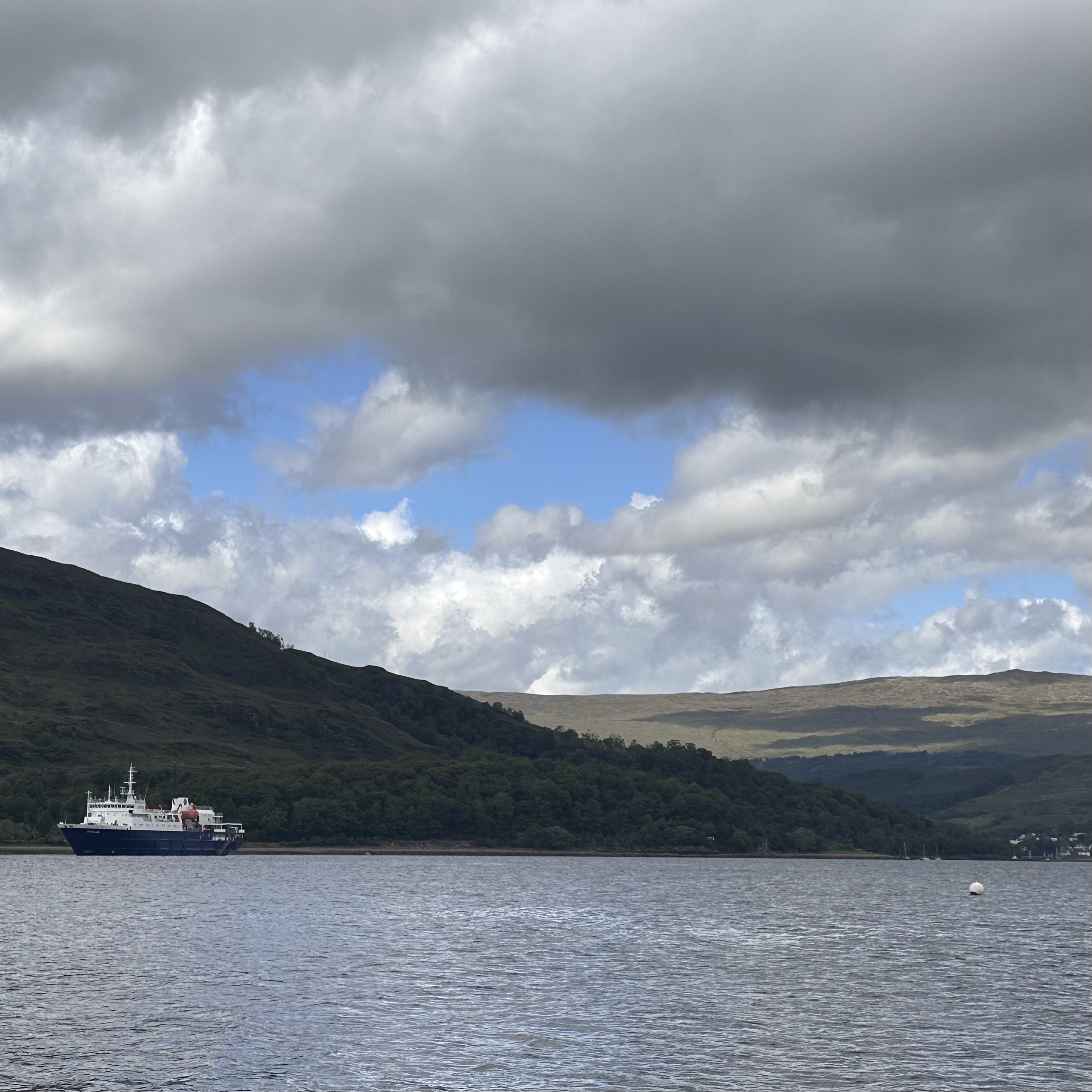
We arrived at the Fort William Pontoon where dinghys were waiting for us in the light rain to reach our ship “The Ortelius” that was anchored out in Loch Linhnhe. One of the many lakes or lochs (in Scottish Gaelic) carved out during the last ice age 20,000 years ago that gives the Scottish Highlands its character. As a result, the shores are abundant in wildlife, nature reserves and dramatic castles created by men from different clans who couldn’t get along with each other back in the 12-13th centuries.
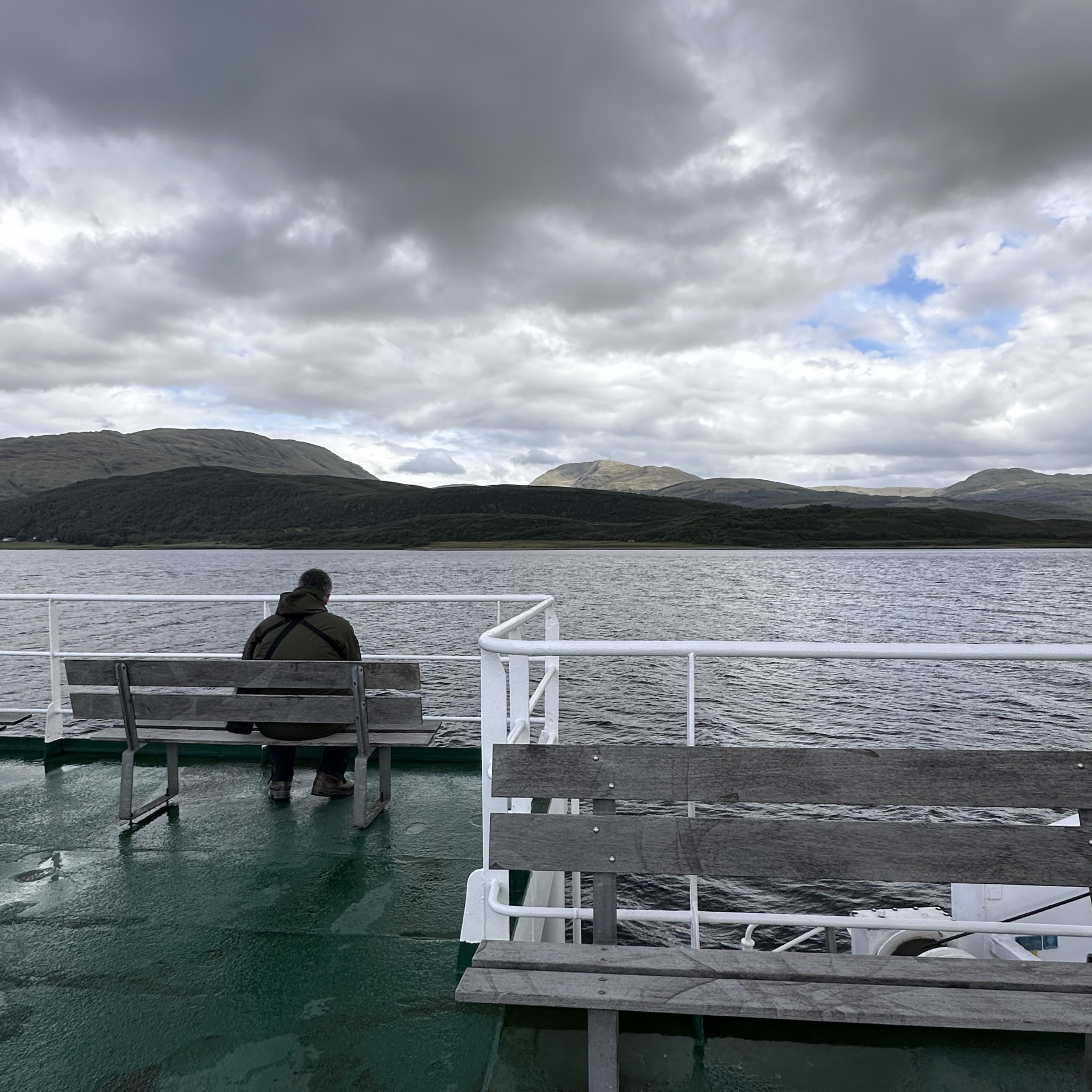
After ship formalities and safety instructions, we sailed out through Corran Narrows and towards the Outer Hebrides approaching The “Small Isles”, made up Rum, Canna, Eigg that looked like rocks with geological significance. It drew a crowd of people calling out bird names, looking through binoculars.
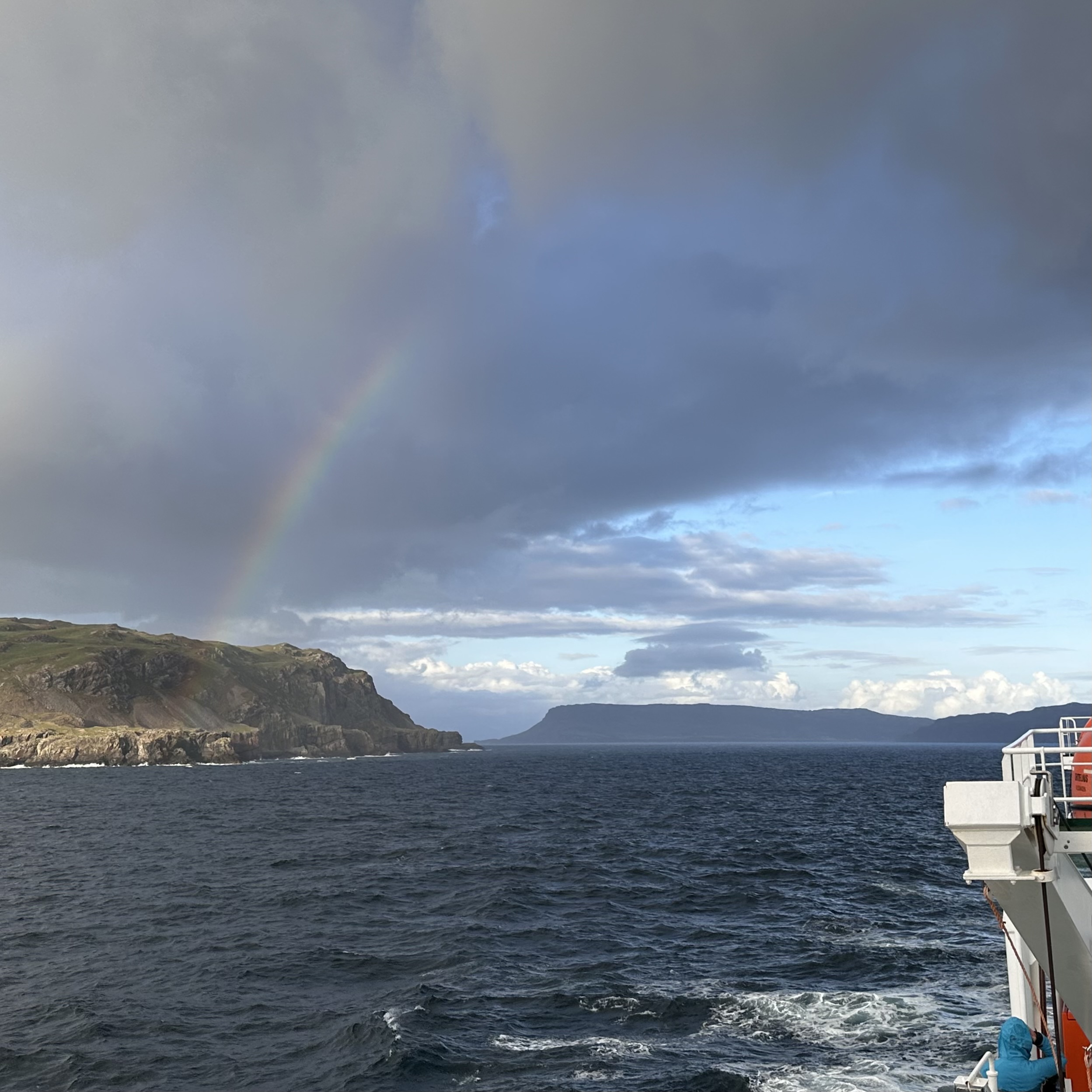
Only later did I learn which rock was which. Rum‘s volcanic peak visible in between Scotland’s capricious weather. Intermittent sun, drizzle and erratic wind patterns is what we endured to see a beautiful rainbow on the horizon and head towards more rocks.
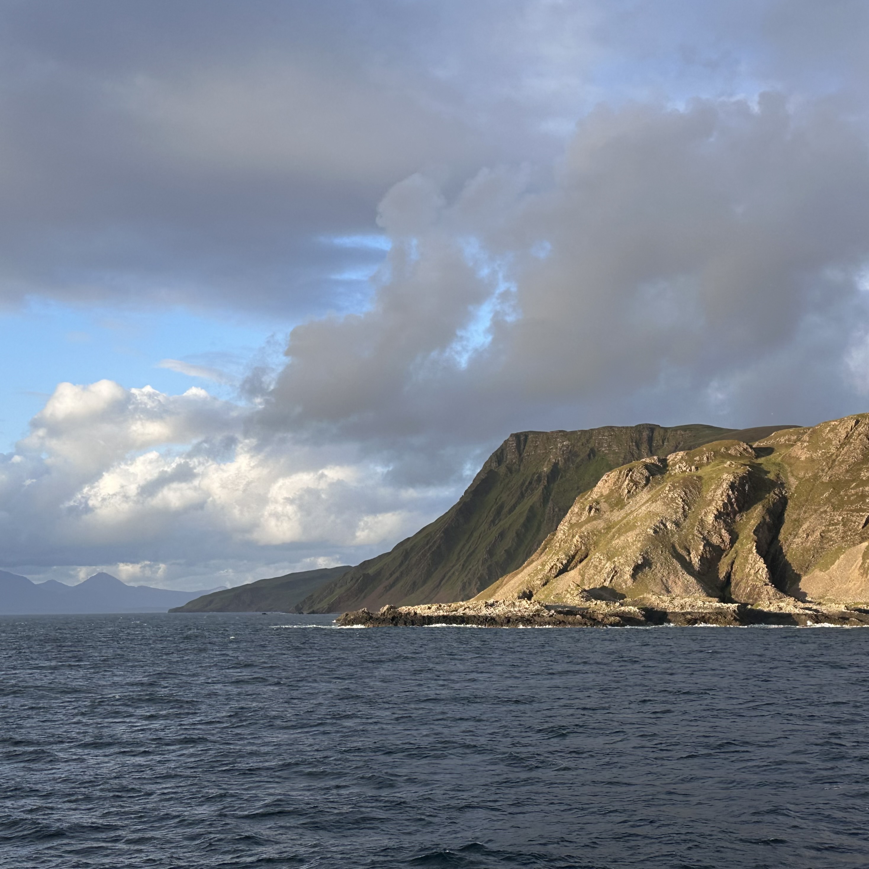
Canna’s 200m dramatic cliffs rose out of the sea, sea birds in all shapes and sizes hovered around so the name calling began once again. Some pointed to the sky and others to the water because whales and dolphins could surface at any moment. These isles are known for amazing wildlife like herds of deer and sea eagles. It lies south of Isle of Skye where golden eagles and otters are common residents. Meanwhile, I saw variations of sea birds; Arctic Skuas, Terns, Fulmar, Cormorant, Puffins, Kittiwakes to name a few. I learn later that a grey seal and a red deer were spotted too.
Day 2 – St Kilda Archipelago
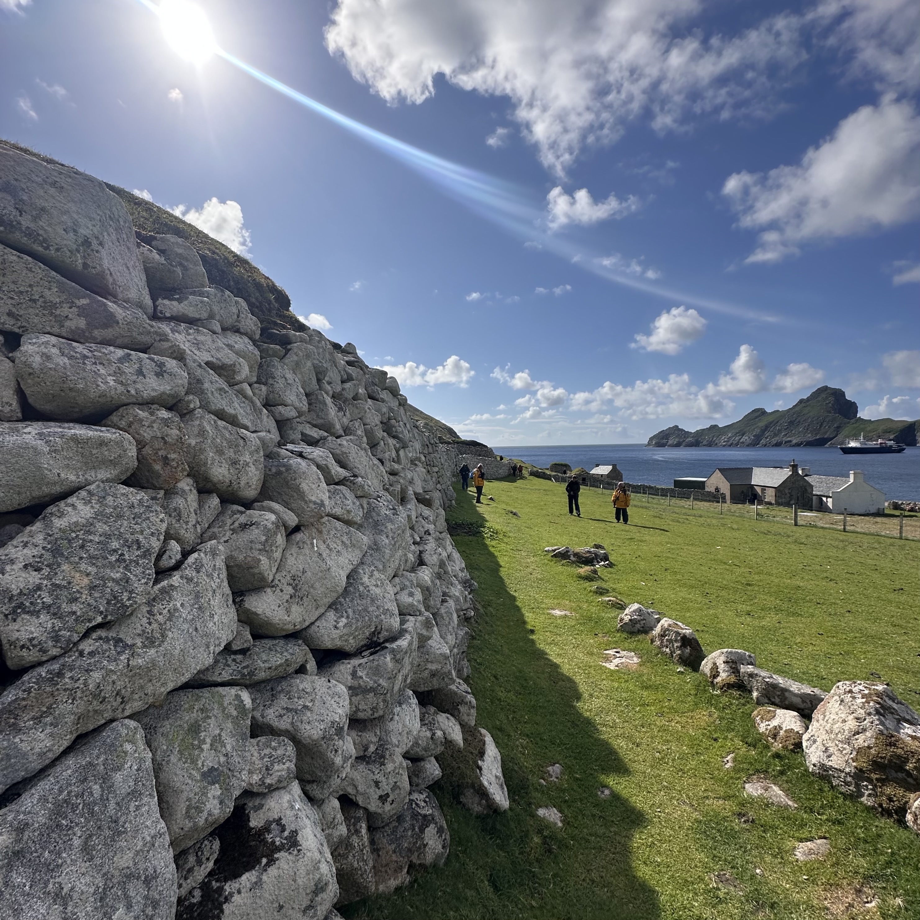
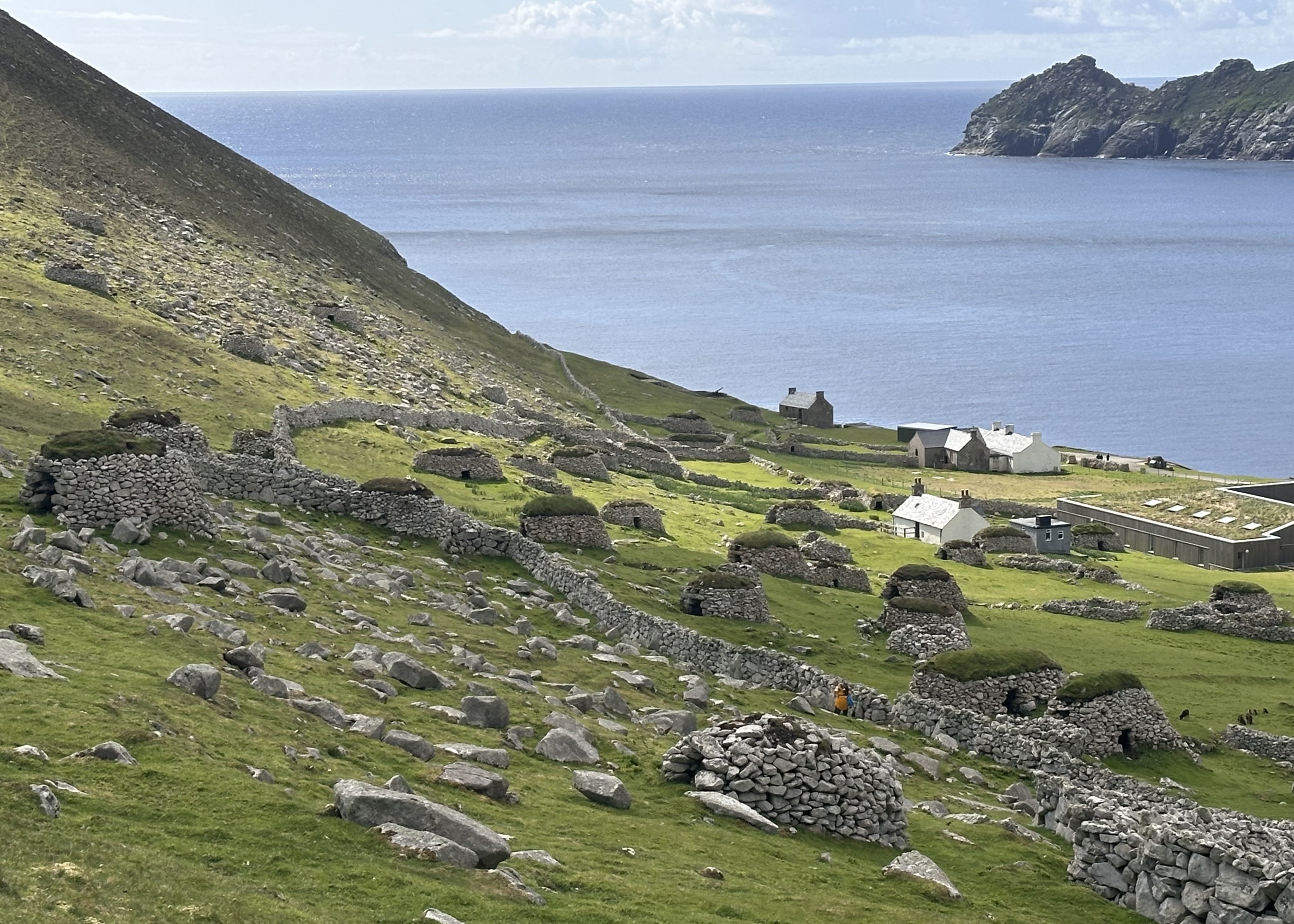
In the morning, we were headed to St Kilda Archipelago, one of the volcanic chains formed after North America, Greenland and Scotland were torn apart and the Atlantic Ocean was born, over 60 million years ago. We sat through a quick orientation by one of the volunteers from the National Trust for Scotland who lives on the island to work on various conservation and guiding projects and then we were off to the island to amble around remains of a village on Hirta, populated with abandoned stones, a few old houses and military telecommunications paraphernalia.
Centuries ago, the St Kildans lived in isolation “Pura Vida” and were left in the dark about the world beyond the island. It was not until the 16th century when they were exposed to outsiders who took advantage of their agriculture (oats and barley), introduced Christianity (they were Druids), disease and in the 18th century military personnel.
The rest is history. The natives abandoned the simple life in 1930 and left it to feral sheep, sea birds and visiting wildlife photographers. Namaste. Now it’s populated with large populations of Puffins on the island of Dun that’s right across one of the Hirta viewpoints of which I traded for a steep hike to “The Gap” that exposed dramatic cliffs populated with thousands of nesting seabirds like Northern Fulmars, Gannets, Kittiwakes, Arctic Skuas, Guillemots and Arctic Terns feeding and gliding by. Little did I know, these birds followed us the entire journey to Svalbard.
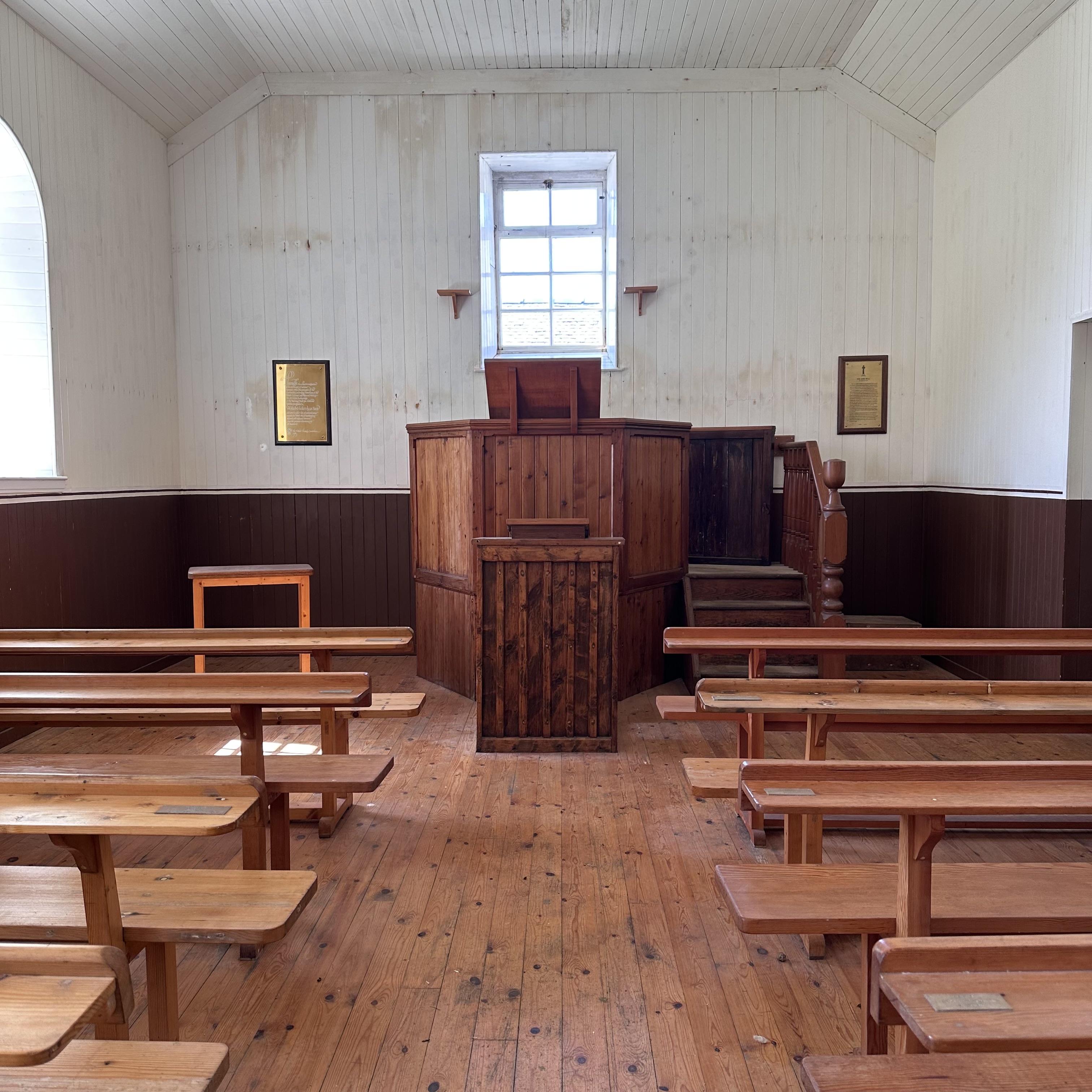
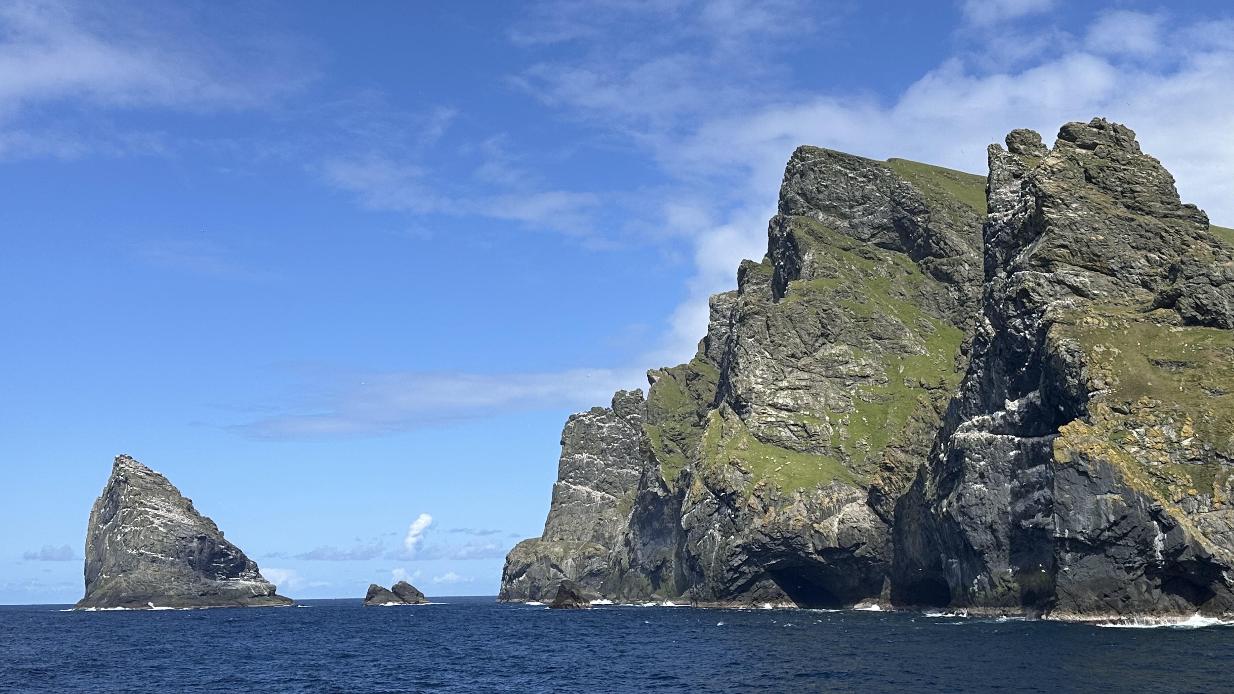
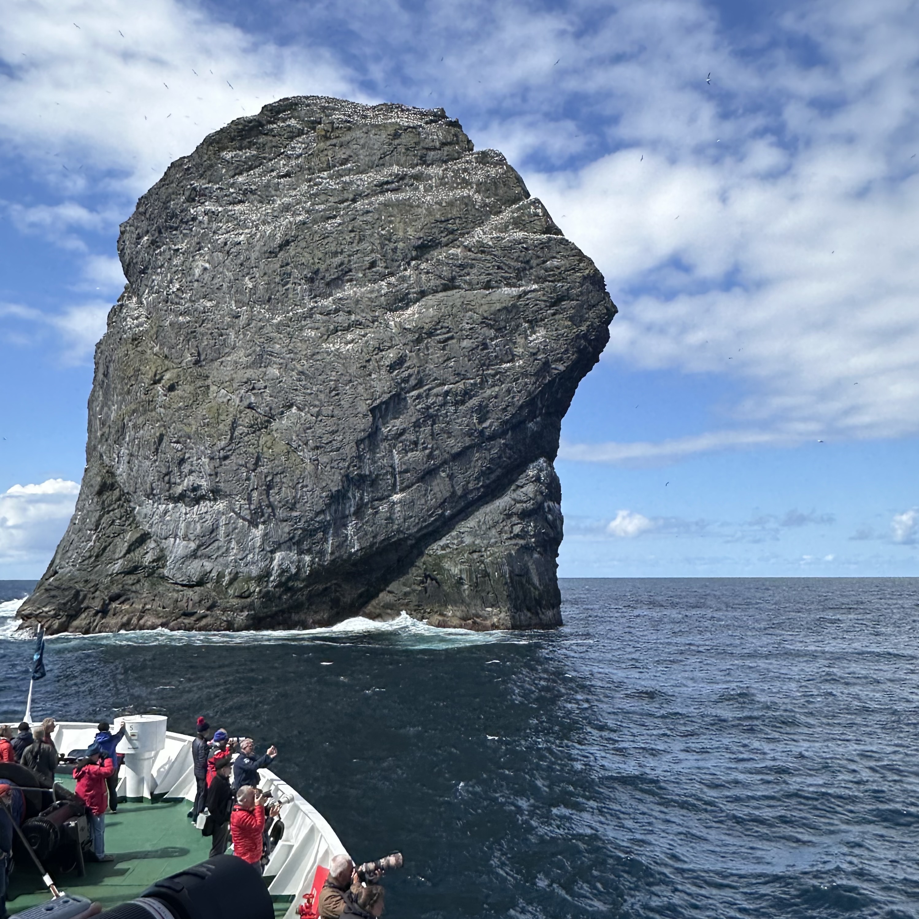
The smaller islets in the St Kilda archipelago, Stac an Armin, Stac Lee and Boreray were visible from “The Gap” because puffy white clouds and clear skies can only mean one thing; It could be the last time we see this. It was unusual, so I sat on a rock to cherish the moment and observe the birds that flitted between grazing sheep and their ewes. On the way out, I checked out the church that was recently restored to portray what it looked like in the 1920s. It was here where residents of the island were introduced to formal education and how being self sufficient is not sustainable.
Since we hadn’t seen enough rocks, later in the afternoon, we headed several miles north towards the two Stacs and Boreray to get a closer look at the geological formations and the second largest colony of Northern Gannets on Boreray (at the time), the guide pointed out 60 thousand breeding pairs. It was only a week ago (of writing this post) when a drone footage showed that now it is the largest colony thanks to the rugged rock formations on St Kilda which stops the spread of Bird Flu; the disease that spread and reduced their number on Bass Rock in 2022, just another rock on the east coast of Scotland.
We were within a stone’s throw to the rocks, as the captain maneuvered the boat delicately so everyone could poke their noses and smell what gannets do everyday like nesting on steep cliffs covered in guano and seaweed. The island that was once occupied during the Stone Age had gannets circling, plunge diving and gliding overhead. Back in the day, the islanders climbed up these cliffs to hunt for gannets (guga meat) from St Kilda. I tried my best to admire these rocks while I struggled to find an angle or work on photo composition.
We called it a night because our plan for the next day included seeing another rock.